PIE (Pixel Information Expert)
flagship software
product of PIESAT for remote sensing image and data processing.

PIE

PIE-Ortho

PIE-SAR

PIE-Hyp

PIE-UAV

PIE-SIAS

PIE-AI

PIE-Map

PIE-Engine

PIE-SDK
PIE-Engine
Remote sensing computing cloud service platform
PIE-Engine remote sensing computing cloud service platform is based on remote sensing technologies (cloud computing, IoT, bid data, AI, etc.) and cloud computing infrastructure, to carry out standardized integration and operation on multiple industrial applications. The platform covers the whole data processing process of “collection, storage, calculation, management and application” of spatial-temporal data, providing one-stop “cloud + local” services. It provides online multi-source remote sensing satellite image data production, processing, intelligent interpretation, analysis, as well as industry-oriented SaaS application services, so as to maximize the value of massive remote sensing data, and promotes the industrialization of remote sensing applications.

Calculation results of national vegetation index based on Landsat-8

Analysis results of vegetation growth variation in Jinzhou in 2017

Urbanization progress of Beijing from 1985 to 2017

Analysis results of water body change of Chaohu Lake from 2017 to 2019

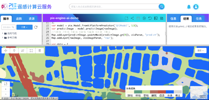
Real-time land classification results based on AI algorithm